Boynton Island West
Region: Boynton Canyon
Total Distance: 5.5 Miles + 1,100’
Difficulty: Hard
ACA: 3Alll
Duration: 5-7 hours
Rope: 2 x 10⁵’
Anchor Materials: 25’ of webbing + 4 rapides
Longest Rappel: 105’
Parking: Park at Boynton Canyon TH. Permits and restroom available at the kiosk.
Overview: Another one of Boynton’s gems, If you’re into ruins, alcoves and good rappel sequences, then look no further. The challenging approach and funky dismounts make this an ideal route for the experienced canyoneers. Those new to Sedona or canyoneering may want to warm up on slingshot or ponderosa before attempting the island routes. Experienced canyoneers will make easy work of this one and likely combine it with another route close by.
Short but demanding Approach
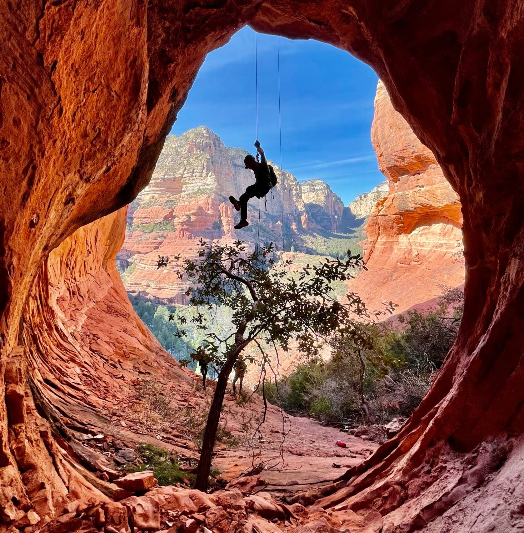
Luxurious Alcoves
Fun free-hanging rappel sequence
Archaeological Sites
Approach (2 hours): The approach starts at Boynton Canyon TH. Start on Boynton Canyon trail passing the famous vortex and Kachina Woman Spire on your right and a private resort on your left. As you near the end of the resort and pass Kings cave keep your eyes peeled for a social trail on the left. The social trail cuts between the large bulbous sandstone feature named “The basketball dome” and Boynton Island. The Island is the first light colored Coconino summit on your left. If you approach a large old tree trunk (Old Stumpy) on the left side of the trail, you just missed your turnoff. The faint social trail moves quickly up to a cliff band with an easier trail to follow. Follow the cliff band to and bushy gully that grants you access to the adjacent ledge system. Follow this ledge past a small set of crumbled ruins, passing a more pristine ruin just around the corner. Shortly after the well preserved ruin you will encounter the first of 4 obstacles:
(1) Short climb- turn left and scramble up a steep 15 foot break with one bolt located at the top on the right. This bolt can be used to place a temporary hand line for those who may need it. Continue up low angle slab toward the brushy gully. Navigate through the gully to the next obstacle.
(2) Boulder- Obstacle two is a large chockstone that must be surmounted, removing and handing off the packs may be useful here. Follow the shelf around and up a section of slabby sandstone to the main ridge.
(3) Exposed ridge- Navigate the ridge towards the main summit, routefinding and exposed downclimbs will come into play.
(4) Airy step- To cross the ridge just after the exposed downclimb there are two options, either an airy step across on the right, or an alternative short scramble up the center and over loose/bushy terrain. Pick your poison!
Descent (2-3 hours): After the last obstacle start traversing or trending left dropping down the West side of Boynton Island and towards R1 at the head of the red rock alcove system. The obvious sandstone sundeck below is a good spot to gear up and decide how to access to R1. Originally we traversed over to R1 on a narrow ledge with some exposure. Afterwards, R0 was placed above the R1 anchor on a large tree for those less comfortable with the direct traverse. I have also found it an easy down climb from directly above the R1 anchor.
R1: 80’ from Large Juniper. Stay LDC to gain next ledge
R2: 105’ from bush LDC. Aggressive edge, rope protector recommended. Please remove any fixed edge protection from this anchor.
R3: 100’ off bush above boulder in watercourse. Great photo opportunity!
R4: 100’ off tree to the bottom. Or 80 to big ledge and down climb the last 20’ of slot.
Exit (1+ hours): Continue down the drainage and head right out of the alcove system, following a faint trail that connects with Boynton Canyon Trail. Turn right onto Boynton Canyon trail where you can either call it a day or enjoy another route close by.
Coordinates:
Approach Turn off: 34.9225, -111.8565
Link Ups: Start with Boynton Island West, then link up with: Slingshot, Chopper Drop, Mushroom Drops, or Ponderosa
Weather: During wet or icy conditions the approach for Boynton Island should be avoided and the Link up options above would be better choices.
Preservation: Please respect the sensitive terrain and archaeological sites along your journey!
Route Established By: Lars Romig, Eric Moorcroft, & Christian Eaton


