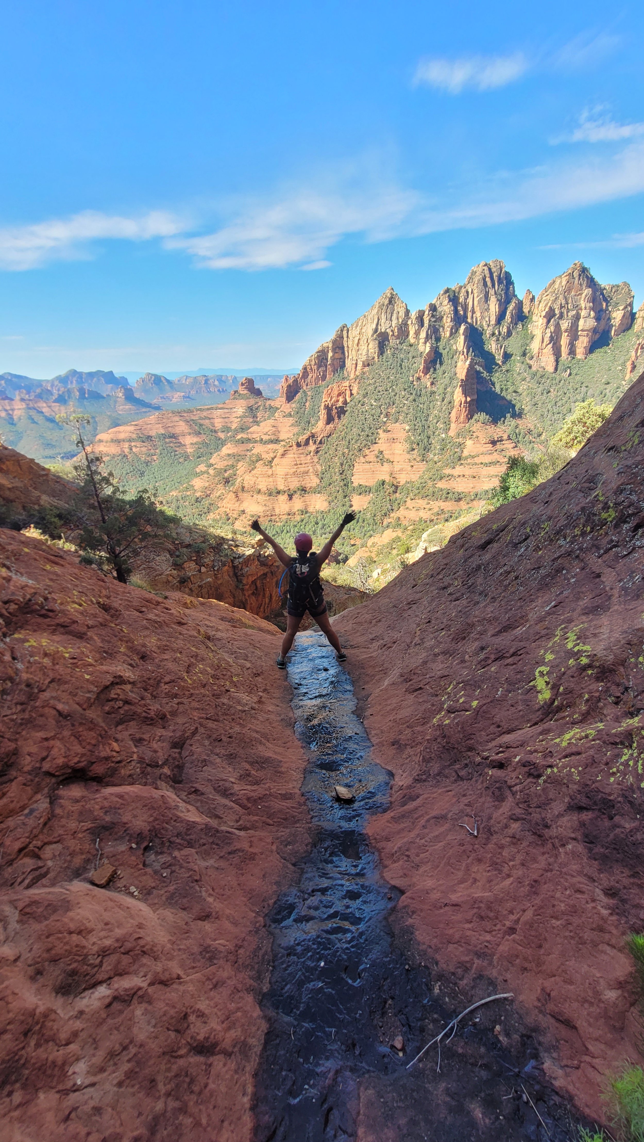
Kegn Moorcroft soaking up the views.
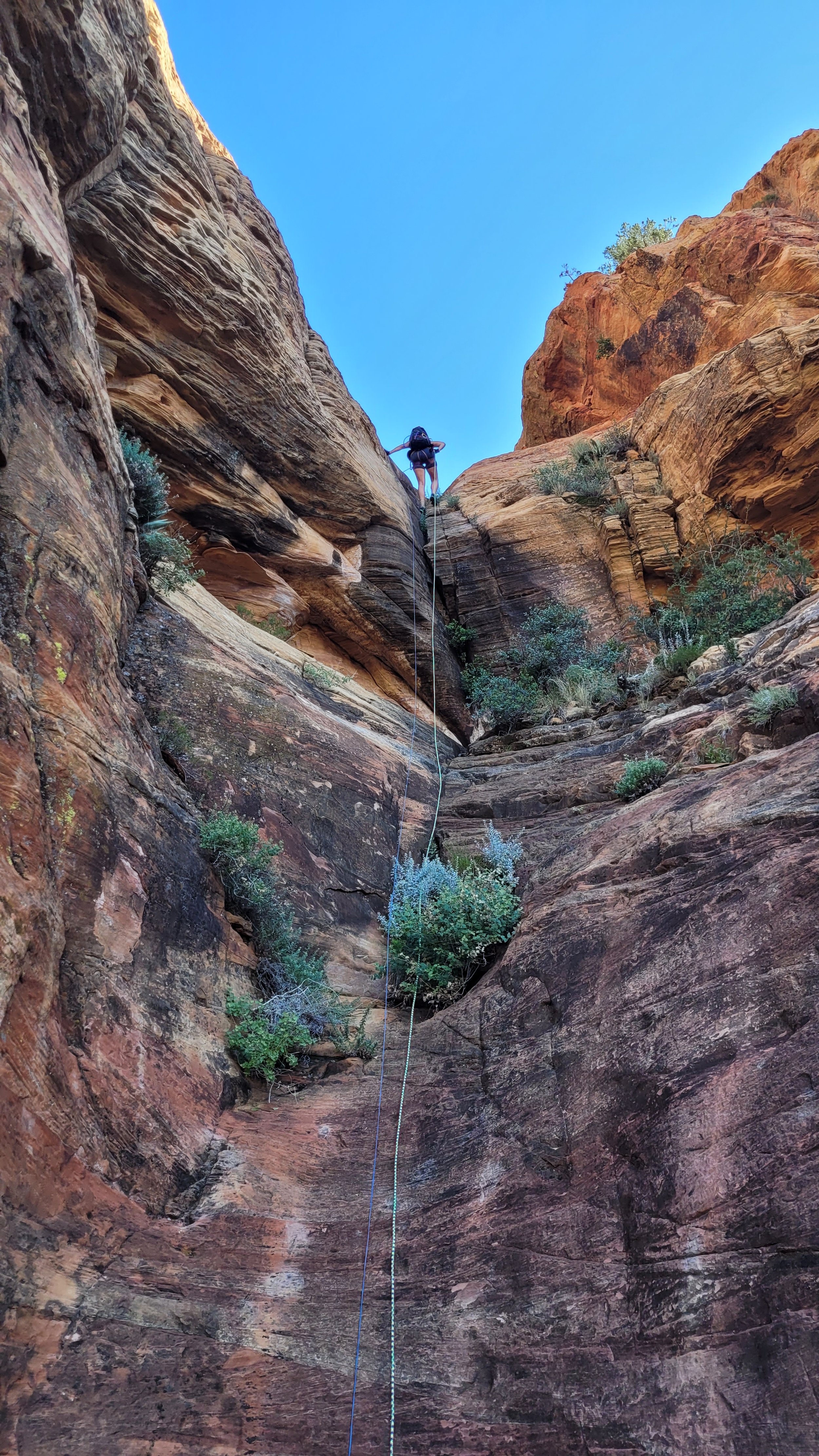
Kegn Moorcroft rappels through the sandstone layers.
Kegn works her way into the red rock layer .
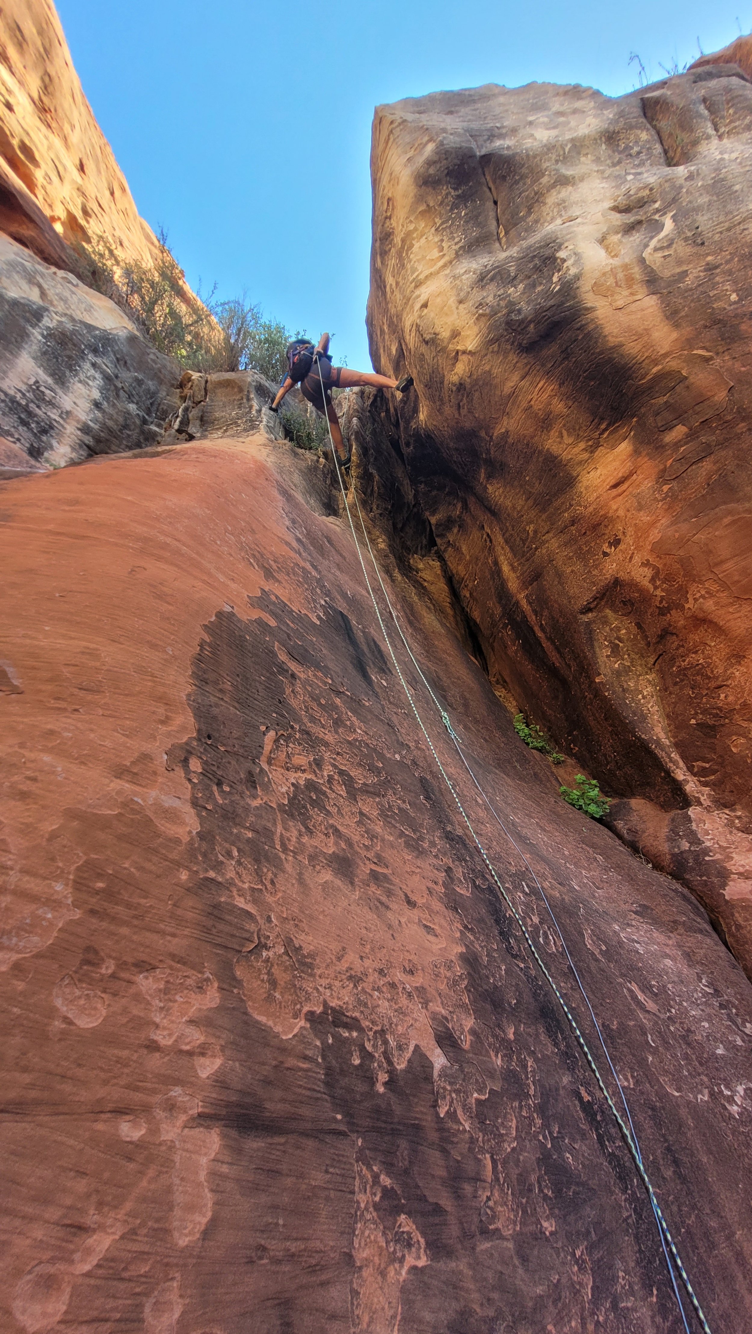
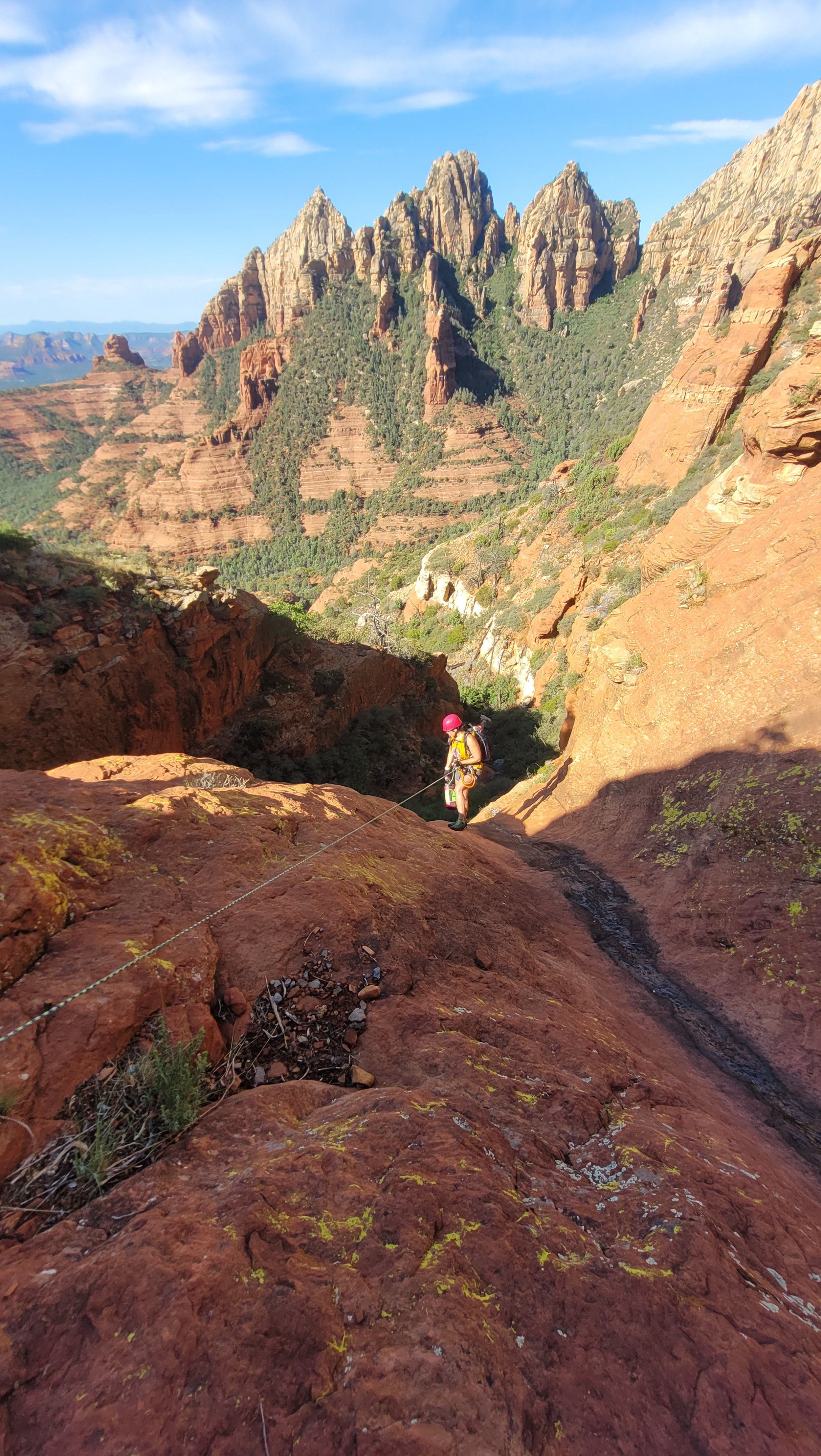
Kegn on rappel :)
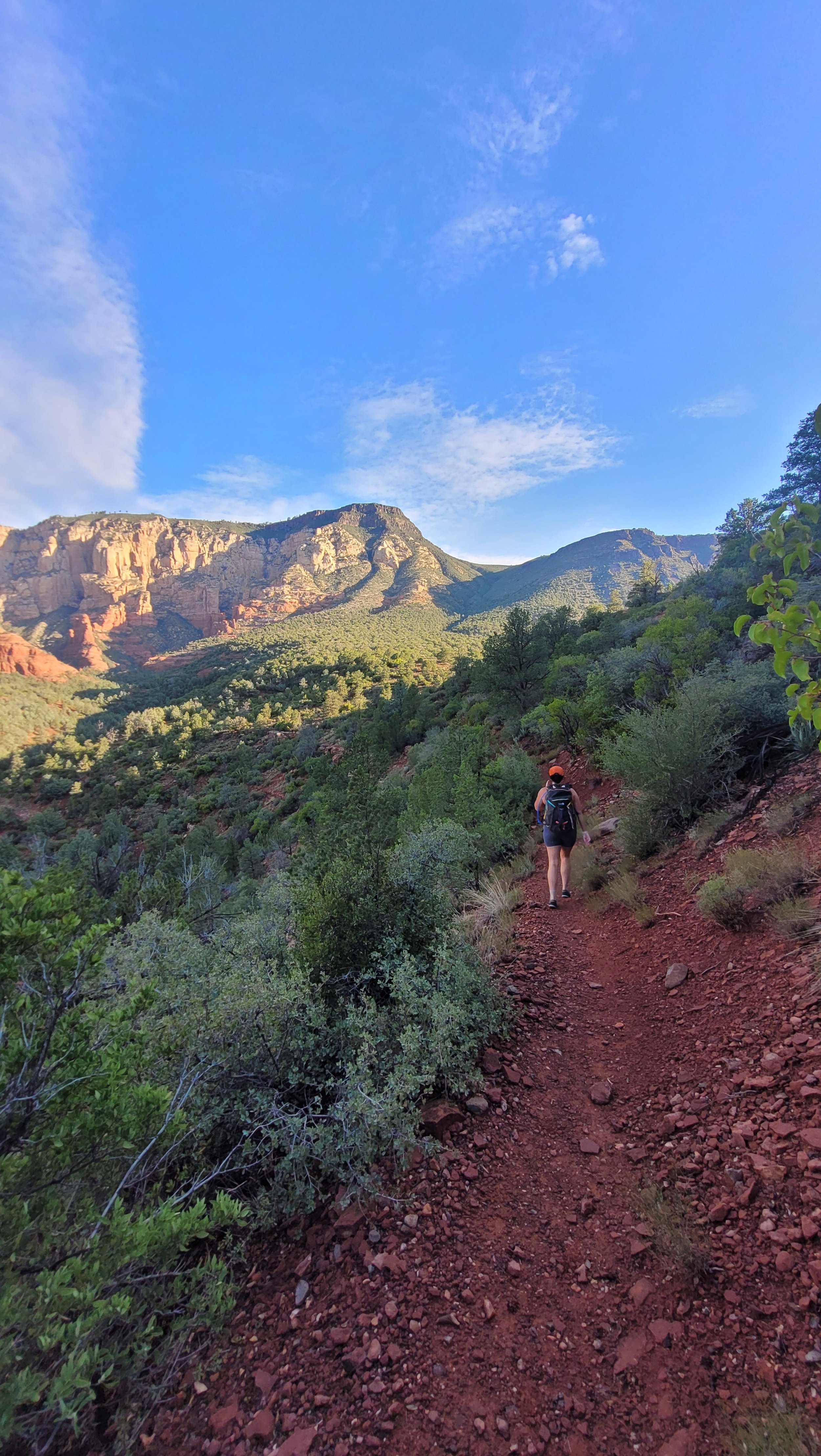
Enjoying the early part of the approach on an established trail.
Wilson Mountain Canyon_
Region: Wilson Mountain
Total Distance: 3.5 miles, 1,050’
Difficulty: Easy to Moderate
ACA: 3All
Duration: 4-5 Hours
Longest Rappel: 105’
Rope: 2 x 110’
Anchor Materials: 40’ of webbing +5 rapides
Parking: Park at Midlgey Bridge Wilson Mtn TH.
Additional parking can be found at Encinoso picnic area but requires a shuttle, longer approach, and mundane effort.
Overview: Wilson Mountain Canyon is a relatively short and straightforward canyon that ends in Oak Creek making this route a good option during the hotter months. This canyon is typically dry and could be enjoyed in the winter as well, although snow and ice will make it more challenging. The recommended loop is from Wilson Mountain trail and finishing at the creek during hotter months. An alternate up canyon approach and exit are provided for those who wish to skip the non-technical section of the lower canyon. This up canyon approach will be especially challenging to impossible during icy or wet conditions.
Moderate but short approach
Easy Dismounts/ short rappels
Scenic and straightforward
Well shaded in canyon
Finishes at Oak Creek
Approach (1.5 hours)- From the Midgley Bridge parking take the Wilson Mountain trail located on the right just past the restroom. Continue up Wilson Mountain trail 1.72 miles until the trail parallels a slick rock drainage on the left or West side. Leave the trail before it bends right and away from the drainage. Traverse the right side and hike down and across the watercourse. A faint trail and scattered cairns lead the way up the short but steep ridge between the slick rock drainage and the canyon. Follow the ridge and faint trail to the entrance of the canyon next to a 15’ pine on the cliffs edge. Recommended approach during icy or wet conditions
***An alternate approach and exit are available on the map, and utilize an out and back strategy via Wilson canyon trail. This option is shorter, but less scenic and cuts out some of the best parts of the route.
Descent (1-2 hours)- Downclimb into the water course arriving at the first drop and a pile of large boulders set back from the edge.
R1: 105’ Boulders in watercourse.
R2: 95’ Tree LDC.
R3: 60’ Boulder in watercourse.
R4: 105’ Pine in Watercourse. 120’ in wet conditions.
R5: 70’ Tree LDC out of watercourse.
Exit: Gear down after the last rappel and take the drainage down to the main wash . Cross over the wash and join Wilson Canyon Trail. Follow Wilson Canyon Trail back to the main parking lot.
Or…
If you have extra time, leave the trail and follow the canyon down below the bridge and to the creek, where paradise awaits. There are two 15’ drops to negotiate in the watercourse before arriving at Oak Creek. From Oak Creek head upstream on Huckaby trail and back to the Midgley Bridge Parking Lot.
Coordinates:
Turnoff (From Wilson Mtn Trail): 34.89884, -111.74376
Video Courtesy Of : Jerry Arizona