
Eric Moorcroft on the last rappel of Grizzly. Photo by Todd Martin
Terry Brenneman on the last rappel.
Kegn Moorcroft on the lovely 2nd rappel.
Terry Brenneman going over the edge on rapp #2.
Views looking into Fay Canyon. Terry on rappel.
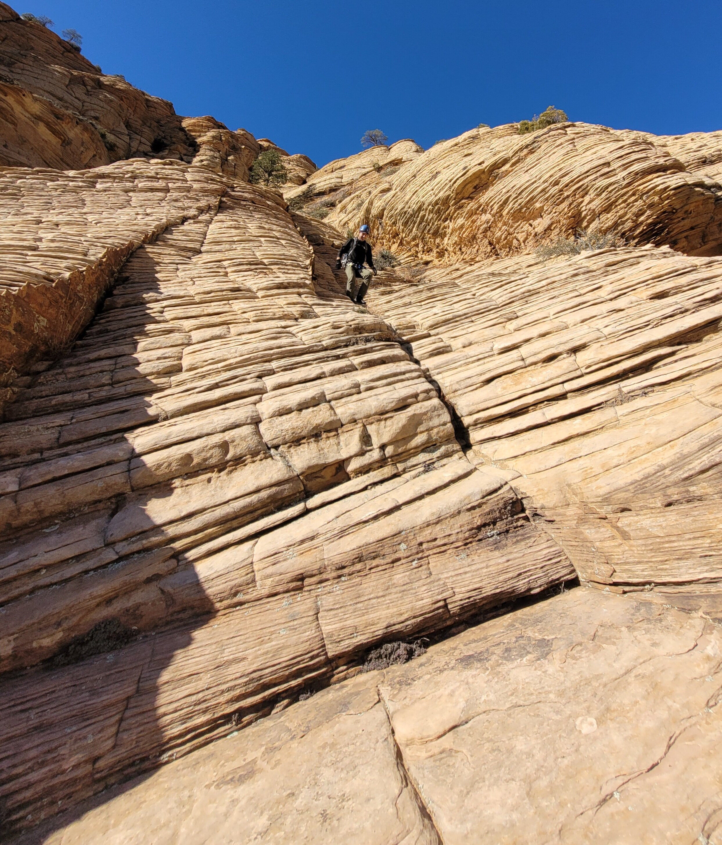
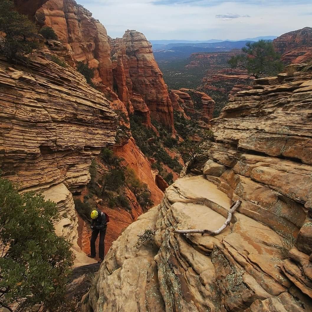
Jason down hiking the coconino layer.
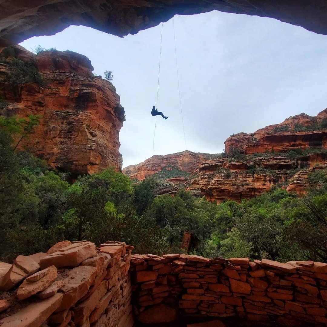
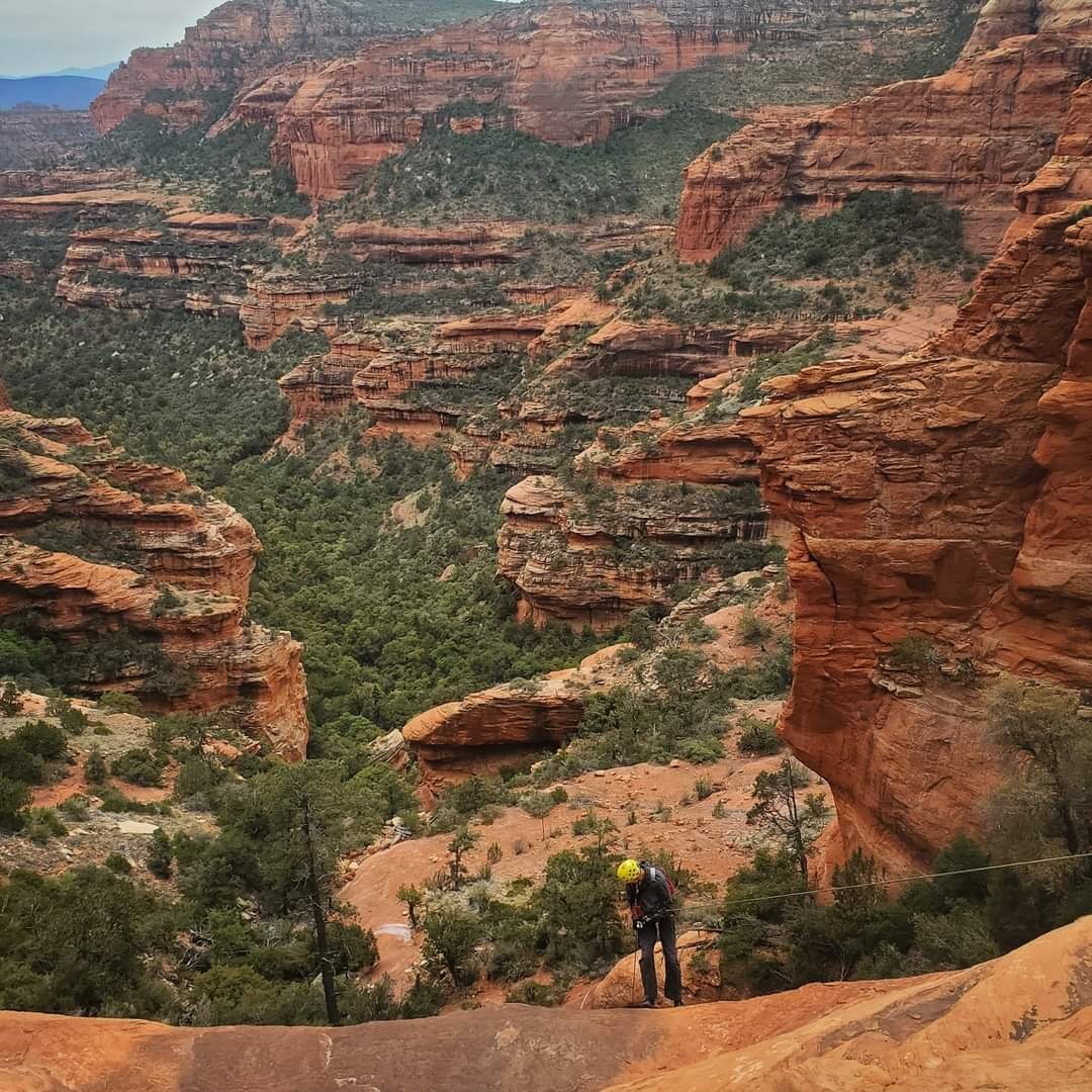
The Red Wall Rappel.
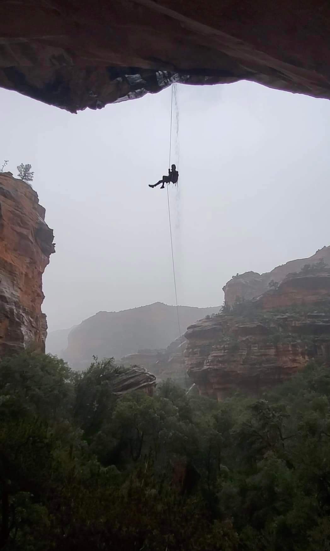
Grizzly on a wet and moody day.
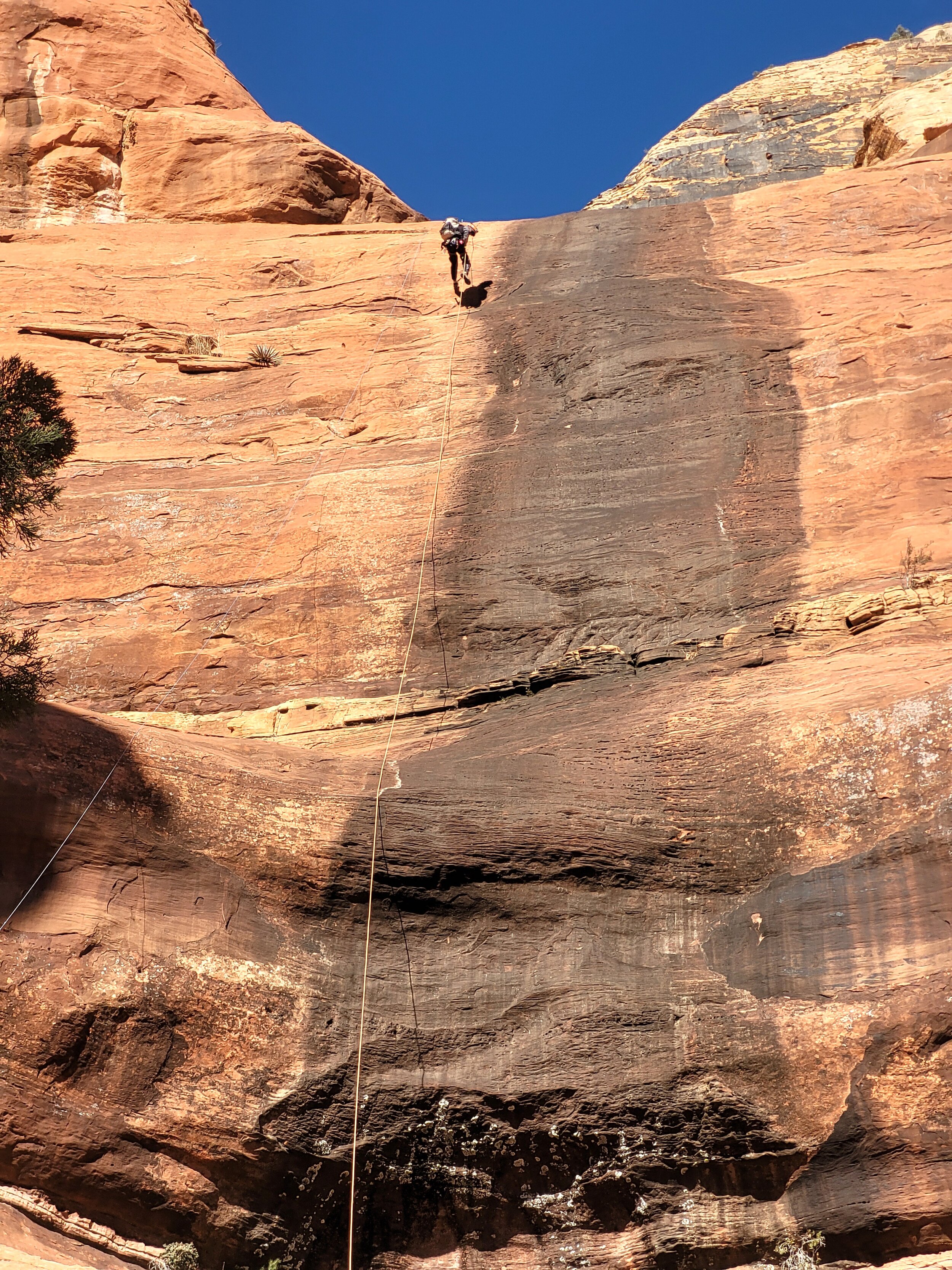
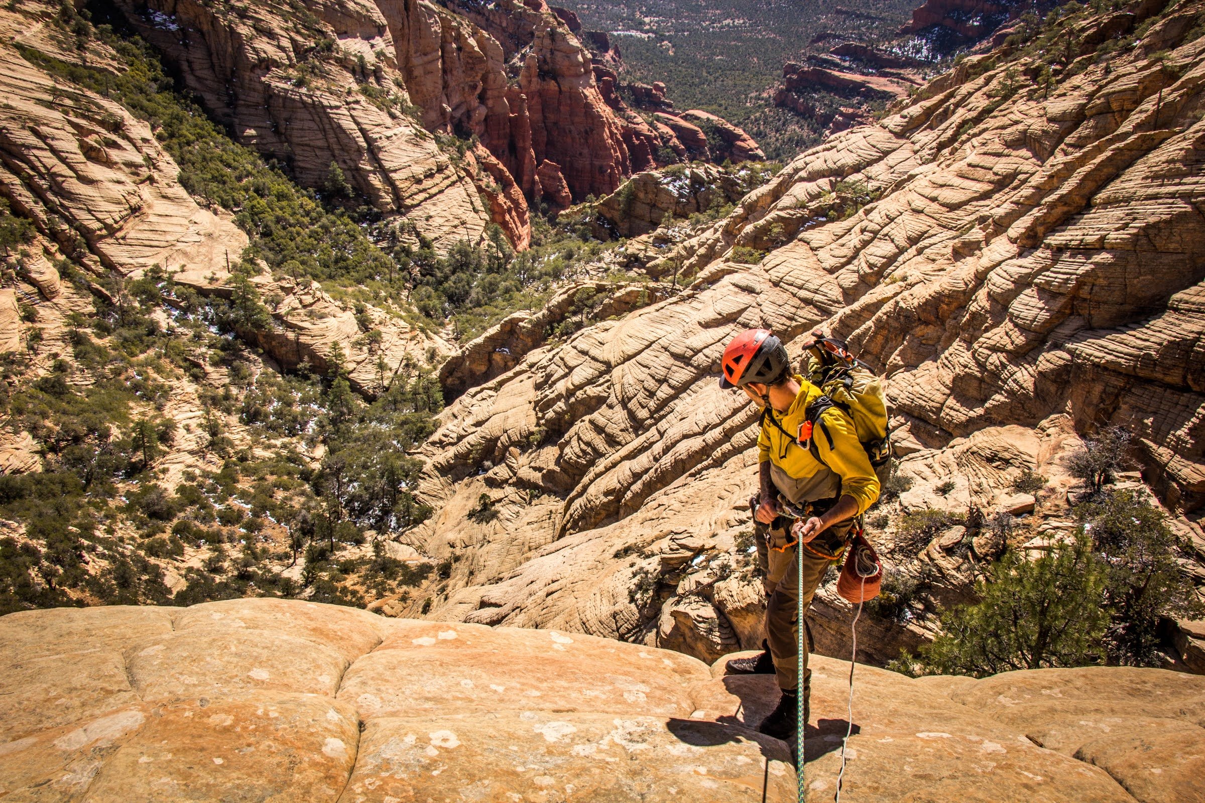
Todd Martin on rappel.
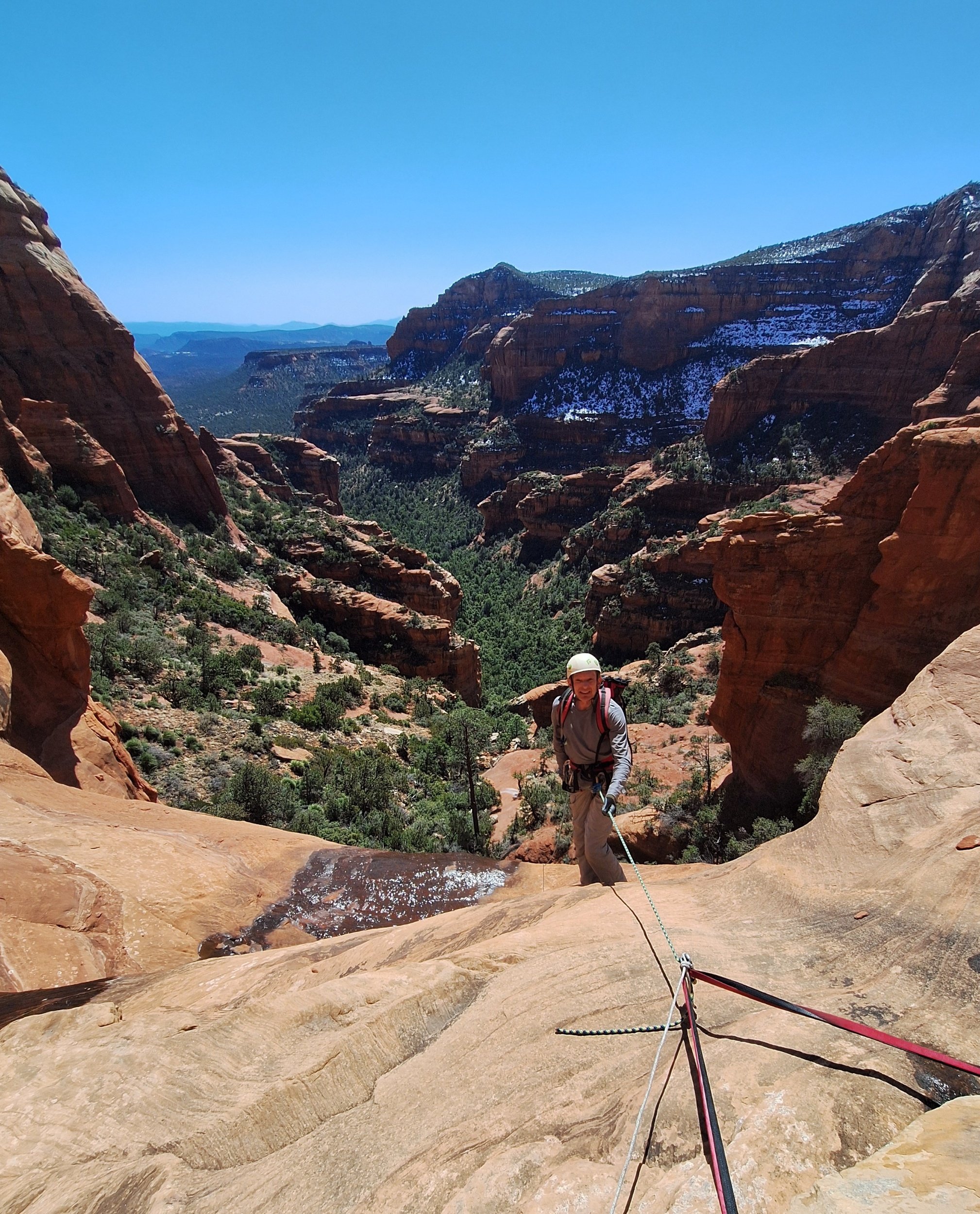
Eric Moorcroft at the first mandatory rappel. Photo by Todd Martin.

Todd Marting enjoying the views from Grizzly Canyon.
Grizzly
Region: Bear Mountain
Distance: 6.5 miles/ 2,000’+
Difficulty: Hard
ACA: 3Alll
Duration: 6-8+ hrs
Rope: 2 x 200’
Anchor Materials: 80’ of webbing + 6 rapides
Parking: Park at Bear Mountain Trailhead for the start. Parties with an extra vehicle may want to leave a shuttle at Fay Canyon TH (less than 1/4 mile away).
Overview: Grizzly Canyon is the most coveted Sedona classic recommended for experienced adventurers craving a full day adventure. The approach features sweeping red rock views and a 5-star hike to one of Sedona’s most prized summits, and is followed by some of the best rappels in the red rocks. Depending on time restraints and weather conditions there are a few less committing options along the way, after entering the canyon you are committed to the route with little chance of escape or retreat. This geography of this route lends itself to a serious risk of flashflood potential. If circumstances or conditions warrant bailing you may save the day by attempting Dillinger as an alternative.
Demanding and Scenic approach
Steep downclimb
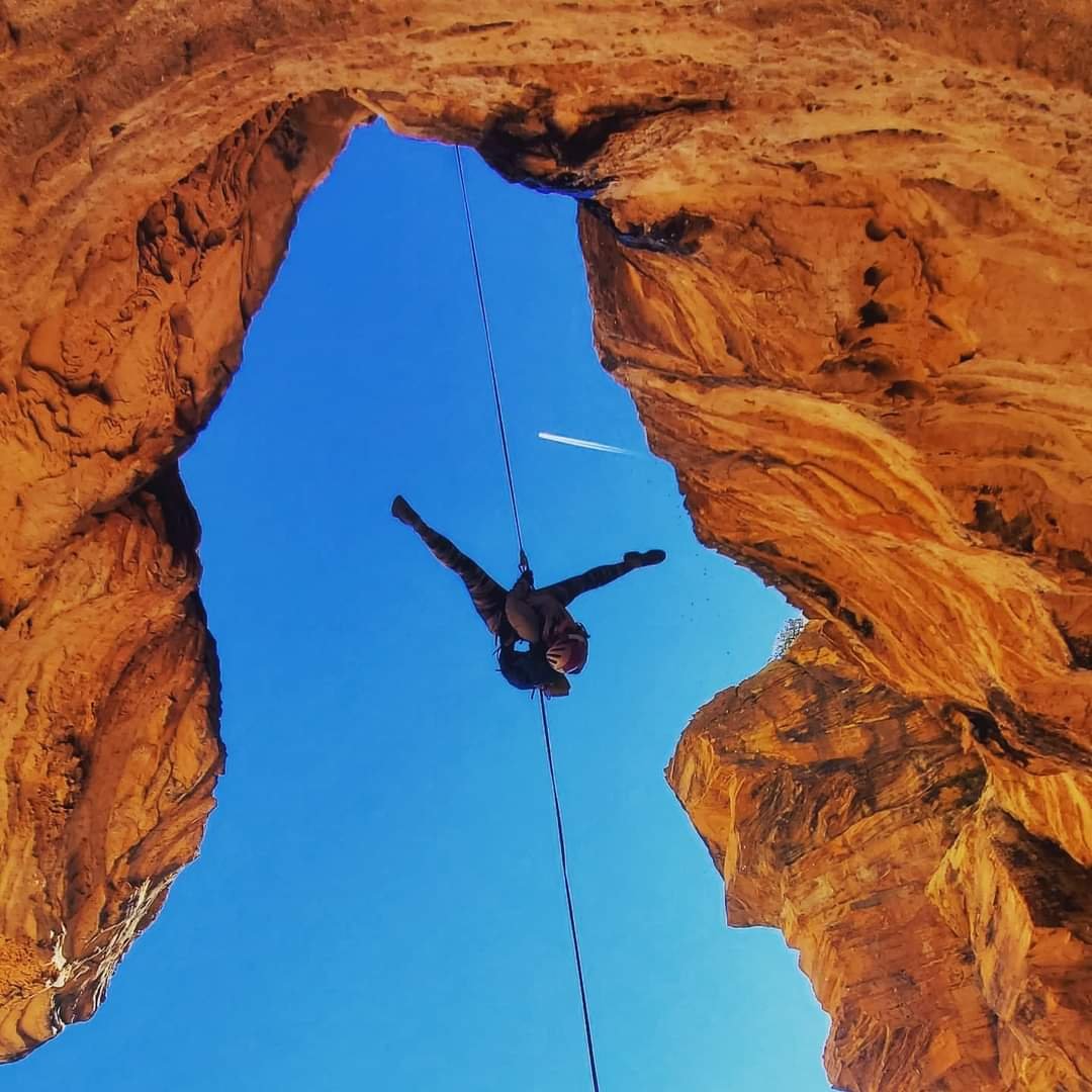
Free hanging rappels
Archaeological Site
Great with runoff, but dangerous depending on flash flood/weather conditions
Approach= 3.5 mi, 2.5-4 hrs+: Not recommended during snowy or icy conditions
From the Bear Mountain TH hike about 2.5 miles to the trail end (estimated 2 hours), enjoy the views from the summit and take a quick break. There is still about a mile of navigation from the summit which can be hiked in under an hour. From the trail end follow a faint social trail North through dense patches of agave and manzanita. Route finding across this section can be difficult until the vegetation clears and you are greeted with fantastic views of Grizzly Ridge. If circumstances warrant retreat Goldie Drops is an alternative to hiking back from here. Follow the coconino ridgeline with fantastic views looking down into Boynton Canyon until arriving at the entry downclimb (1 hour). The views looking down from Grizzly Ridge are some of my absolute favorite in the area, providing an excellent backdrop for gearing up and snacking down.
Descent=1/2 mi, 2 hrs+: Looking down from the entry downclimb you will spot a tall lone pine down on a ledge on the left . A steep 150’ downclimb on the left side down sloping coconino, will land you at the lone pine tree and R1.
** An optional R-Zero of approximately 50’ has been placed at the base of a bush above the first downclimb for slippery conditions and for those who prefer to rappel.
R1: 150' off of large pine tree on small ledge LDC. It is recommended to trail the rope on this rappel to avoid bushes and loose rock. Retrievable anchor not recommended.
Downclimb ~200'+ of steep coconino slabs with anchor options if needed.
Continue through water course to the next drop.
R2: 75' off of tree LDC. Free hanging into a beautiful coconino alcove landing on the red rock layer.
R3: 190' off of boulder RDC to large ledge. Three stages - will pass two ledges while on rappel. A retrievable anchor works well here.
R4: 100' off of tree LDC to the bottom.
R5: 50' off of tree. Best to down climb to first ledge before getting on rope.
R6: With the webbing extended 20’ from the tree the last rappel is ~125' . Trail the rope as there is high potential of throwing it into a tree, and there may be hikers down below. A retrievable anchor works well here.
Exit= 1.25 miles, Less than 1 hour:
Gear down after the last rappel and start down-canyon towards the drainage. Once in the drainage continue boulder hopping to the Fay canyon trail end. Take a left onto Fay Canyon trail and hike back to the TH approximately 1.3 miles.
Coordinates:
Goldie Drops (retreat option): 34.9182, -111.8727
Preservation: Please respect sensitive terrain and archaeological sites along your journey.
Low Impact: Mindful rope management and other low impact practices will help to preserve this highly sought after route.
Route Established By: William Lan, John Hewitt, Jim Clarkin, & Brian Deavila
Video courtesy of: Jerry Arizona